Aim
- Collect rainfall and rainfall runoff data in urban areas by installing a sensor network for hydrological monitoring of runoff and rainfall as a basis for planning, design and evaluation of green infrastructure.
Description
At the watershed level as a unit of study, the implementation of a hydrological monitoring network allows for a more detailed understanding of the relationship between rainfall and runoff (flow). Such information is essential for the technical design of water infrastructure and its evaluation after implementation. The data obtained can also be used in hydrological models to forecast the behaviour of the urban water cycle under different precipitation events. The process includes the processing and analysis of results, with the characteristics of the sensors used being relevant for the resolution of such models.
The paper presents a series of suggested steps to be considered during the installation, maintenance and data download of an urban-scale monitoring network. The installation involves the interaction with different actors involved in the dynamics of urban water management.
Steps
1. Identification of space
A general understanding of the space is relevant for the decision on the type and magnitude of the monitoring network. Understanding the hotspots or points of interest should be done from an area of hydrological influence perspective, whether at catchment, sub-catchment or micro-catchment level. Runoff is the water that circulates on the surface following rainfall events. In the urban case, understanding the magnitude and distribution of runoff allows to identify the necessary size of infrastructure to limit its negative effects. A watershed is the area of land surface where the runoff generated over it drains to the same outlet.
a. Relevant locations for the study: identify monitoring points through field visits
Guided visits or individual field explorations determine the sites that need to be monitored either because the population dynamics are high or because of the specific interest of the monitoring target. Field visits in the initial stage are essential as they provide the manager with a practical insight into the processes occurring in the catchment. It is also recommended to carry out such visits in both dry and rainy seasons. Thus, potential locations for sensor sites can be verified, including aspects of access and spatial conditions. In addition, local committees and institutions are an important baseline for identifying hotspots.
SEE-URBAN-WATER: The points where flooding occurs in the lower part of the basin were identified, with rapid urbanisation upstream being the main cause of this phenomenon.
b. Definition of the scope of the variables to be monitored allows the type and resolution of the sensors to be installed to be identified
Defining the use of the data allows defining the installation points and type of sensors. For example, a high spatial variation of rainfall in the catchment may require more than one sensor in order to correctly quantify its distribution. The types of sensors selected may also depend on the type of monitoring needed, including the accuracy and maintenance required, as well as the ease of manipulating them in the field
SEE-URBAN-WATER: The objective of having high resolution hydrological models at different spatial scales defined a measurement resolution of the instruments of less than 5min for the water level and 0.2mm for each rainfall record.
c. Identification of previous local efforts related to monitoring allows integration of data collected so far
Previous efforts may exist in the area of interest related to monitoring activities. Such activities may be dispersed among different stakeholders. Bilateral meetings with stakeholders can identify data collection actions that have been carried out in the past, which can be included, complemented or contrasted with efforts to install a new monitoring network
SEE-URBAN-WATER: An existing monitoring system for flood early warning was identified in the study area, which provided approximately 3 years of rainfall records.
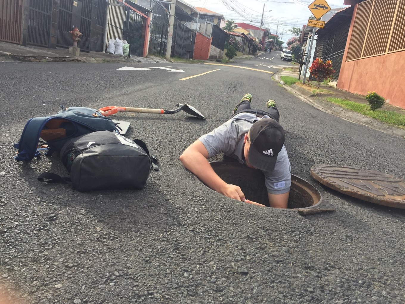
d. Identification of monitoring points
The location of sensors to measure rainfall is recommended to be spatially distributed in the catchment. This depends on the number of available sensors, the monitoring area, and the spatial variation of rainfall. In small areas where a uniform distribution of rainfall is expected, one sensor may be sufficient; two sensors allow for data backup and comparison of records for validation. In larger areas, local knowledge about rainfall distribution allows approximating the location and number of sensors. Installation is recommended in open, safe areas and at least 1.5m from the nearest surface.
The location of sensors to measure runoff is recommended at the end of the catchment. This allows the total catchment area to be related to rainfall and runoff. The location of sensors at intermediate points of interest requires determining the ratio of the corresponding drainage area up to that point.
Sensors may be subject to vandalism or vulnerable to being lost during flood events. It is recommended that robust structures such as bridges or walls be used to ensure the permanence of the sensors.
SEE-URBAN-WATER: A rain gauge was installed in the middle part of the catchment. The sensor was located on top of a public shelter protected by a lock. This allowed to reinforce the security and permanence of the sensor. However, entry to the sensor had to be coordinated in advance, so a planned coordination of activities was required in conjunction with those responsible for access to the site. In addition, four spatially distributed sensors were installed along the river. The sensors were placed on the lateral surface of bridges at low flow level, secured by a system of tubes. Two sensors were probably lost due to insufficient reinforcement in the structure, which weakened during flood events and solids entrainment in the river.
e. Existing constraints such as legalities, formalities or permits help to reduce inconvenience during installation
Limiting factors include those that make installation and access to the selected points difficult, or that present a lack of security for the correct functioning of the equipment (vandalism, extreme weather events). Access to monitoring points should be carefully analysed as such activity may be restricted by private owners, difficulty and danger of access (e.g. river gully), need for additional materials or instruments (e.g. ladders). In addition, it is recommended to consider the legal formalities and requirements necessary to allow access and installation, which depending on local regulations may be complex.
SEE-URBAN-WATER: Bridges are potential locations for the installation of sensors because they are more easily accessible, protected from flooding and have a lower risk of theft. Limitations are the formalities and procedures required locally to affect public infrastructure, despite the minimal scale of intervention during installation. For the installation of sensors that measure rainfall, public buildings where access does not depend on a dedicated person are recommended.
2. Proposal development
a. Equipment and instruments needed, their installation and acquisition requires determining purchase and maintenance costs
The simplicity of handling the equipment, cost, level of accuracy required and maintenance necessary define the most suitable type of sensor. It is recommended to quote prices with more than one supplier to get a price perspective.
SEE-URBAN-WATER: Rainfall measurement was carried out using a rocker-type rain gauge with an accuracy of 0.2 mm due to the advantage of high accuracy data and the ease of manipulating the sensor during data download. In the river, in-water pressure sensors were chosen to correlate the data with the respective water level height using atmospheric pressure as a reference. The sensors allowed for fast data download and field validation of the results
b. The monitoring plan should include documentation of specific observations and conflicts during data collection to understand possible inconsistencies in the data
The frequency with which data will be downloaded is planned, including field coordination activities for access to sensors. The plan should include the necessary materials, responsible persons and instructions for action on site
SEE-URBAN-WATER: Access to monitoring points was coordinated in advance with neighbours and institutional actors. For example, a rain gauge was installed in a municipal building with restricted access, entry was coordinated a day in advance.
c. Transport of sensors must take into account local availability and/or import restrictions
In case of importing sensors, it should be taken into account that customs permits for their transport may be required by local authorities. It is recommended to have signed and stamped letters of justification to avoid problems during transport
SEE-URBAN-WATER: The sensors were purchased in Germany and transported to Costa Rica. To avoid problems at customs, letters of certification for the use of the equipment for academic purposes were provided by the project coordinator, a university and a local municipality. These were requested at the time of immigration and there were no problems.
d. Field installation: generally requires pre-testing and calibration of the equipment
Once the correct functioning of the sensors has been checked (including calibration), it is defined how the sensors will be installed at the desired locations. This may include additional equipment needed for proper attachment of the sensors, electrical power sources or field materials. Such equipment and activities should be coordinated in advance.
SEE-URBAN-WATER: One municipality supported the installation of sensors under bridges and culverts. A problem in the field was access to electrical power, which is solved with an external battery. Having the right tools for the installation represented the biggest challenge.
3. Monitoring plan
a. Monitoring campaigns: Supporting information should be available during contingencies (manuals, contacts)
Monitoring should include necessary field manuals and instructions, access advice, telephone numbers of network actors and responsible parties. In addition, there should be specific details on how to download and manipulate the data.
SEE-URBAN-WATER: An instruction manual was elaborated together with those responsible for the discharge of records. It included the necessary material and instruments, instructions for action on site and specific recommendations. Since the monitoring was carried out by students, remote supervision and immediate availability was a constant to resolve doubts immediately
b. Data maintenance and recording: it is recommended that a reference nomenclature be defined in advance to be used for each record download activity
The collected data should be further supported by site- and sensor-specific nomenclature. It is recommended to use the same nomenclature to avoid confusion. For each discharge activity the date, person responsible, location and additional observations should be recorded. It was also proposed to carry out inspections of the sensors during the monitoring campaigns to verify the correct functioning of the sensors. This activity was carried out by manipulating the sensors in a controlled manner and verifying the data obtained. Such manipulations should be recorded to avoid confusion with the real data.
SEE-URBAN-WATER: Each monitoring point was named by an abbreviation according to sensor type and location. During the monitoring, specific sheets were filled out for each monitoring point describing weather conditions, water levels or additional developments were recorded in a monitoring activity log. The record also included the person responsible for the activity.
Results
Hydrological data for design, numerical modelling and evaluation of green infrastructure.
Rules
- Relevant aspects of the monitoring points are access and security factors.
- Direct communication with those responsible for monitoring activities is necessary, including preferred communication times.
- For correct use of the sensors, pre-installation training is recommended, including calibration, downloading, emptying memory, changing batteries, or updating software versions used.
- Field materials and other additional instruments for field trips should be stored together and should be easily accessible to avoid loss and mishaps.
Scopes and challenges
- The guide presents an overview of the process of setting up a monitoring network. The use of this guide is recommended in the context of initial efforts where no previous experience or advanced knowledge of hydrological monitoring is available. The document is based on field experiences, which were carried out by university students and in conjunction with local stakeholders.
- The cost of the sensors will depend on the brand, type and resolution of the sensors. In the case of the SEE-URBAN-WATER project, a Hobo-RG3® rain gauge with a resolution of 0.2mm was used. Baro-diver® pressure transducers were used to approximate the height of the water level based on the pressure difference inside and outside the river. The approximate costs were 450 USD for the rain gauge and 2000 USD for the pressure transducers, including instruments for downloading records.